After spending the first part of this varied Midland circuit amid quiet rural scenery, this month we head through the Black Country and Birmingham before returning to the countryside again

10 riverside pubs to complement this guide
In the first part of this guide we followed the four contrasting waterways of the western part of the circuit; the late 19th century narrow-beam Droitwich Junction, the much earlier wide-beam Droitwich Barge Canal, the River Severn, and finally back to the narrow canals for the 18th century Staffs & Worcs Canal. This time, we follow four more canals (or five, or six, depending on how you count them – see later). But whereas part one followed the attractive rural valleys of the Salwarpe, the Severn and the Stour, this month’s route passes through the heart of the industrial Black Country and Birmingham. You wouldn’t think it to start with, though: as we leave the Staffs & Worcs at Stourton Junction and climb the four Stourton Locks at the start of the Stourbridge Canal, the surroundings remain rural.
The closely-spaced locks followed by a two-mile level pound are a clue that we’re on a slightly more recent canal, opened in 1779, compared with the Staffs & Worcs built just a few years earlier with its locks dotted along the route according to the lie of the land. But we’re still following the Stour, with the little river visible below us to the left at times.

A small aqueduct crosses the river, just before the canal reaches Wordsley Junction. Here the Stourbridge Town Arm bears off to the right; take a one-mile detour to the terminus, handy for the town’s facilities and accompanied by the historic Bonded Warehouse – owned by Stourbridge Navigation Trust and used for meetings, events a trip-boat base.
The Arm was the site of an important event in relatively recent waterways history: the 1962 Battle of Stourbridge Cut, when volunteers with a dragline excavator cleared the canal in the face of opposition from the waterways authority which had been allowing it to fall into dereliction. The confrontation and ensuing publicity (including questions in Parliament, national news stories and threats of legal action) led to a turning point in relations, with the new British Waterways subsequently cooperating with volunteers to put the canal and its locks back in good order.

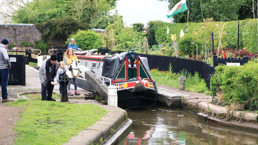
The through route continues with the canal’s major engineering feature; the flight of locks known simply as ‘The Stourbridge Sixteen’. Look out for some interesting features; two locks so close together that they look like a staircase, but aren’t. Like the better known set of three at Bratch on the Staffs & Worcs, they each have their own gates, and are separated by a pound just a few feet long, and a clever arrangement of a culvert leading to a side pond stops this pound from overflowing when a lock is emptied into it. Other notable features are the Red House Glass Kiln alongside the locks (see inset) and Dadford’s Shed, a 19th century wooden canal warehouse now home to a boatyard specialising in historic craft. Meanwhile, the rural surroundings have been replaced by housing and industry, as we head into the Black Country.
Above the locks, the canal runs straight ahead into the distance – but that’s actually a dead-end arm, the Fens Branch, with the through route swinging round to the right. The branch is still navigable for quarter of a mile to a further split at Brockmoor, where the Stourbridge Extension Canal led off. You won’t get far beyond Brockmoor Junction in either direction now, but it’s a quiet mooring with an adjacent nature reserve, and you can turn at the junction.

Meanwhile, the main line twists and turns as it follows the contour around Brierley Hill to where the Stourbridge Canal ends and the Dudley Canal begins below Delph Locks. There’s nothing to mark the change: originally they were both planned as a single canal, and both canals opened in 1779, with the Dudley initially extending the Stourbridge’s route for two miles towards Dudley, with nine locks at Delph.
The steep flight is an impressive sight, made more so by the steep rocky overflow weirs alongside them, and by their greater than average rise. This results from a 19th century rebuilding, with eight new deeper locks substituting for the original nine. The boatmen continued to call them ‘The Nine’ from habit, and this confusion is perpetuated by a nearby pub being called the Tenth Lock.

Formerly heavily industrial, the Dudley’s course today runs past the huge modern Merryhill shopping centre and Waterfront development, built on the former Round Oak steelworks site. Industry returns for the final length of the original Dudley Canal, leading to Blowers Green. Here, the canal was extended in 1791 via a flight of five locks and the long Dudley Tunnel to meet the Birmingham Canal (now the Old Main Line of the Birmingham Canal Navigations). Subsequent changes saw the first two locks replaced by the single deep Blowers Green Lock, while today boats are forbidden from using their engines in the unventilated Dudley Tunnel (they can arrange to be towed by Dudley Canal & Tunnel Trust’s electric boat) – and few craft will fit the tunnel’s tight headroom.
Instead, we will turn sharp right above Blower’s Green Lock, and this is where the number of waterways we’ve cruised gets slightly more complicated. We’re still on the Dudley Canal, but a separate line known as the Dudley No 2 Canal, opened in 1798, linking the original canal (now the Dudley No 1) to the Worcester & Birmingham Canal via the even longer Lapal Tunnel. We follow it for two and a half miles as it follows the contours around Netherton Hill through some surroundings which are at times surprisingly rural, considering its proximity to the industrial Black Country. It too has seen some changes; look out for signs of an old canal going off on the right, the Two Lock Line (yes, it did actually have two locks!) – a shortcut between the Dudley No 1 and No 2 canals which fell victim to subsidence), and the deep cutting where Brewin’s Tunnel was later opened out.

A fine array of BCN cast iron towpath bridges marks our arrival at Windmill End junction. Two dead-end arms leading off on the left (the Boshboil and Bumblehole arms) were originally the ends of a loop of the canal cut off by a straightening exercise, while on the right the Dudley No 2 continued to Selly Oak, but the collapse of Lapal Tunnel meant it now ends after three miles at Hawne Basin, home to Coombeswood Canal Trust. It’s worth the detour for the curiously irregular Gosty Hill Tunnel, and the welcome at the basin.
And finally, straight ahead at Windmill End leads onto yet another (arguably) different canal, the Netherton Tunnel Branch of the BCN, opened in 1858 to bypass Dudley Tunnel. Whereas the old tunnel is too tight for most of today’s boats, the newer one is wide enough to pass each other (useful, as at 3,027 yards it’s one of the longest still in use) – plus a towpath on each side.

Leaving the tunnel, the two-span Tividale Aqueduct carries the BCN Old Main Line over you (there was once a turbine here which used the 20ft difference in water level between the two canals to generate electricity to light the tunnel) before the canal meets the BCN New Main Line at a T-junction.
The result of the last of a series of improvements at various dates from the opening of the original Birmingham Canal in 1772 onwards, this section was opened in 1838. It was a great improvement over the old line which Thomas Telford had described as “little more than a crooked ditch, with scarcely the appearance of a towing path”, but today its dead straight, wide course is perhaps not the most exciting of cruises, unless you’re interested in trains (the Birmingham to Wolverhampton main line parallels it). Do look out for several ‘toll islands’, where the canal narrows into a pair of channels either side of an island on which a toll house once stood, and also for the Gower Branch heading off on the right, and the Wednesbury Old Canal and Spon Lane Locks on the left.

The length through Smethwick more than makes up for any slight lack of interest earlier, with a series of deep cuttings spanned by aqueducts carrying the Old Main Line and the Engine Branch, Telford’s splendid Galton Bridge, and a new ‘tunnel’ created in the 1970s to carry a new main road. On the final run into Birmingham, three loops of the old line have survived the straightenings, and you have the choice of cruising them or staying on the newer route.
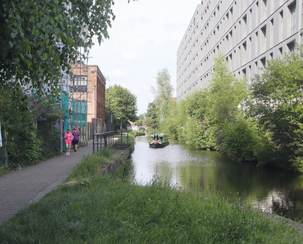
Old industries give way to newer developments (including one huge scheme under way around the Icknield Port Loop), indicating our approach to central Birmingham. The city centre canals have changed almost beyond recognition (see our ‘then and now’ feature in the June edition for some comparisons with the 1970s) as old warehouses and factories have made way for new shops, restaurants and bars in the ‘canal quarter’ of Brindley Place, followed by Gas Street Basin. Many enthusiasts will lament the loss of the old buildings and the feeling of being cut off from the outside world that they created, but Birmingham certainly appreciates that it’s got canals these days.

At Gas Street Basin we leave the BCN and join the Worcester & Birmingham Canal. Here, you can still see the Worcester Bar, the physical barrier keeping the two canals 7ft apart as stipulated in the original Act of Parliament, the result of the Birmingham company fighting to guard its trade from loss to the newer W&B. From the opening of the first length of the new canal in 1795, through cargoes had to be laboriously transhipped over the Bar, but by the time it opened to Worcester in 1815, sense had prevailed and a shallow water control stop-lock bypassed the Bar. Today that lock has lost its gates, so you can just cruise through on the level – but don’t just cruise through without stopping to visit some of the city’s many attractions!
A very sharp right turn by a striking modern building marks the beginning of the canal’s rather secretive course leading out of Birmingham. Like the New Main Line earlier, it is closely paralleled by a busy railway line, but in this case it’s a much more meandering route which runs through a series of narrow cuttings, often cut off from the nearby suburbs. It also includes Edgbaston Tunnel, one of five on the canal, the only one with a towpath (controversially widened recently for the benefit of the large numbers of cyclists and walkers who use it, at the expense of narrowing the navigation channel).

At Selly Oak, look out for work under way to reinstate this end of the Dudley No 2 Canal as part of a retail development, and a step towards Lapal Canal Trust’s long-term reopening plans. Look out also for Cadbury’s chocolate factory at Bourneville.
At King’s Norton Junction, the Stratford-upon-Avon Canal heads off on the left, faced by a fine junction tollkeeper’s house which was sadly very seriously damaged in a recent arson attack.

A long wooded cutting leads to Wast Hill Tunnel. It’s 2,726 yards long (and wide enough to pass in) with no towpath (there’s also no clearly marked tunnel path, but walkers can find their way around it using local roads), and it marks a transformation in the canal. Up to now we’ve been passing through Birmingham’s suburbs; the far portal emerges into fine, rolling Worcestershire countryside.
Bittell Reservoirs provide the canal with a water supply, and unusually the canal runs right along the dam of the lower reservoir. A winding length of canal passes Alvechurch village with useful local facilities and boatyard, before the canal dives underground again at Shortwood Tunnel, followed after another mile (and another boatyard) by Tardebigge Tunnel.

Tardebigge has a place in recent waterways history: look out for the plaque marking where the meeting took place in 1946 between canal revival pioneers Tom Rolt (whose boat Cressy spent the Second World War moored here) and Robert Aickman, leading to the formation of the Inland Waterways Association and the movement to save the canals. And a second ‘erratum plaque’ records that the first one was incorrect, and their meeting was actually in 1945!
Stop and savour the moment, because you won’t get a rest again for a little while. You may have noticed that we haven’t mentioned locks for a while. In fact the last time we encountered one was at Blowers Green, over 25 miles back. But all that changes at Tardebigge Top Lock, as the long level comes to an end and the canal dives down towards the Severn.
I’m tempted to stick my neck out and say that the 36 locks are the longest flight on the system. Yes, I can already hear folks screaming that there are only 30 in the Tardebigge Flight, but the gap between the 30 and the following six Stoke Locks is so short that it’s actually shorter than some of the gaps within the flights. Still, it does have a pub where you can stop to revive yourself after your exertions, so maybe that makes a difference. Anyway, it’s a lot of locks without a break, but they’re not heavy ones, and while it lacks the impressive (if somewhat daunting) views like (say) Hatton or Caen Hill of lock after lock climbing steeply up or down the hill ahead, they do wind their way through some very pleasant countryside. Look out for the metal ‘horns’ set in the masonry at the head and tail of the locks: these were used in horse-boating days for putting the rope around (similarly to using pulley blocks) and getting extra mechanical advantage to get a loaded boat going.
A whole collection of ‘Stokes’ – Stoke Pound, Stoke Prior, Stoke Wharf and Stoke Works – provide a selection of pubs and another boatyard. And then it’s little more than a mile before the locks begin again with the Astwood Flight of six.
The long descent has come to an end for now, with no more locks on the Worcester & Birmingham for over five miles. But for us, it’s less than half that distance to Hanbury Wharf, the junction with the Droitwich Canals, and the point where we began our tour of this varied circuit of Midland waterways.
Image(s) provided by:
Martin Ludgate


