We follow a fascinating northern narrow-beam route from the heart of Manchester to the fringes of the Peak District.
Words and Pictures by Martin Ludgate
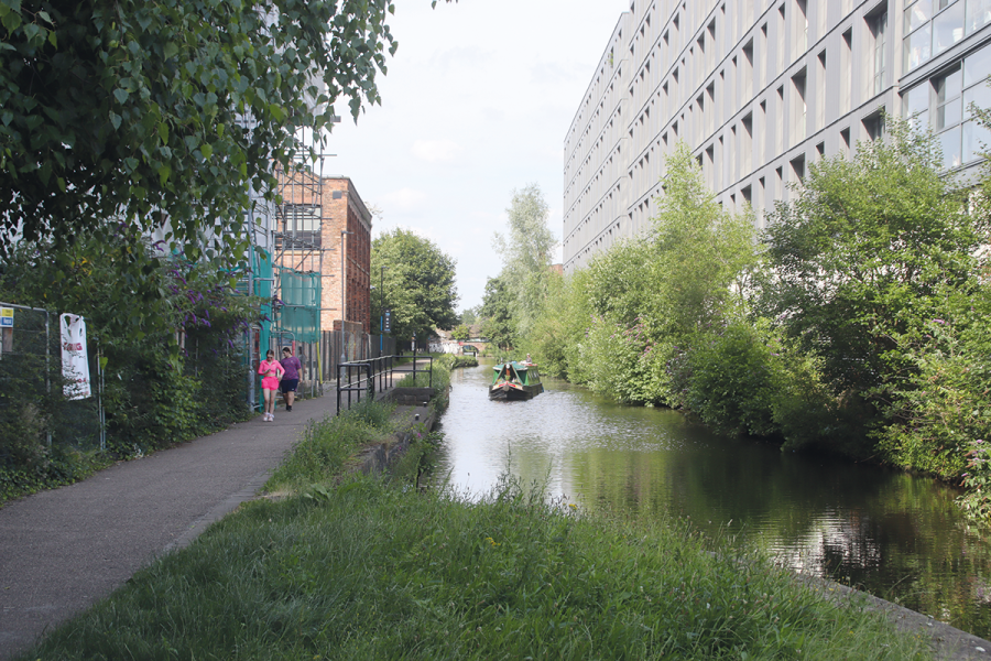
The Ashton-under-Lyne Canal, which forms the first part of our journey this month, couldn’t be more different from the predominantly rural waterways that we’ve featured in recent issues. In contrast to last month’s subject the Chesterfield, or the Shropshire Union which we covered in the previous issues, the Ashton neither strides boldly across the countryside like the Shroppie, nor does it wind picturesquely around it like the Chesterfield. No, it begins in the very heart of Manchester, and its course stays uncompromisingly urban for pretty much its entire six-mile length.
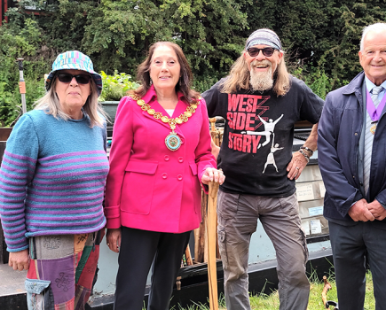
It hasn’t always been everyone’s idea of a popular leisure cruising route – indeed, in the 1960s, it was allowed to fall into dereliction, many saw no future for it, a vociferous local contingent wanted it filled in as a ‘killer canal’ where children might drown, and waterways revival pioneer Robert Aickman was quoted as saying that if the waterways movement could save the Ashton Canal, then it could save the canal system.
But it formed a vital link in a 100-mile circuit of waterways, dubbed the ‘Cheshire Ring’ as part of a campaign to restore it to usable condition, and ultimately it was indeed saved – the canal reopened 50 years ago in 1974 along with the Lower Peak Forest Canal, and the Ring was completed a couple of years later when the connecting length of the Rochdale Canal through central Manchester also reopened. And since then, the reopening of the trans-Pennine lengths of both the Rochdale and Huddersfield canals has made the Ashton even more of a vital link in the Northwest’s network.
As I said, it’s not a rural route. But that doesn’t mean it’s not a pleasant one. A few decades ago one might have said “grimily urban” – I have a 1960s photo looking down the canal towards Manchester amid a forest of smoking chimneys that would do justice to an LS Lowry picture. But today, regeneration and redevelopment surround the initial lengths, with a mixture of new buildings and re-purposed old warehouses lining the canal as it leaves its junction with the Rochdale Canal at Dale Street Basin, passes under Ducie Street, and bears sharp left at the site of the former Ashton Canal Company’s basin. Crossing Store Street Aqueduct and running through the Piccadilly Village residential development, the canal arrives at its first lock.
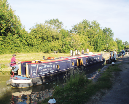
For a short canal, the Ashton is one of our more heavily-locked, climbing through 18 locks all in the western four miles of its six-mile length. But they aren’t particularly hard work, as they’re narrow beam. This is quite unusual for this part of the country – most canals in the north were built broad-beam, to take vessels based on the local river barges. But when the Ashton was being planned in 1792 it was as an isolated canal (the Rochdale wasn’t authorised for another two years), so its builders didn’t see any reason for it to cater for wide boats. It led in due course to the Peak Forest, Huddersfield and Macclesfield canals all also being built to take 70ft by 7ft narrowboats.
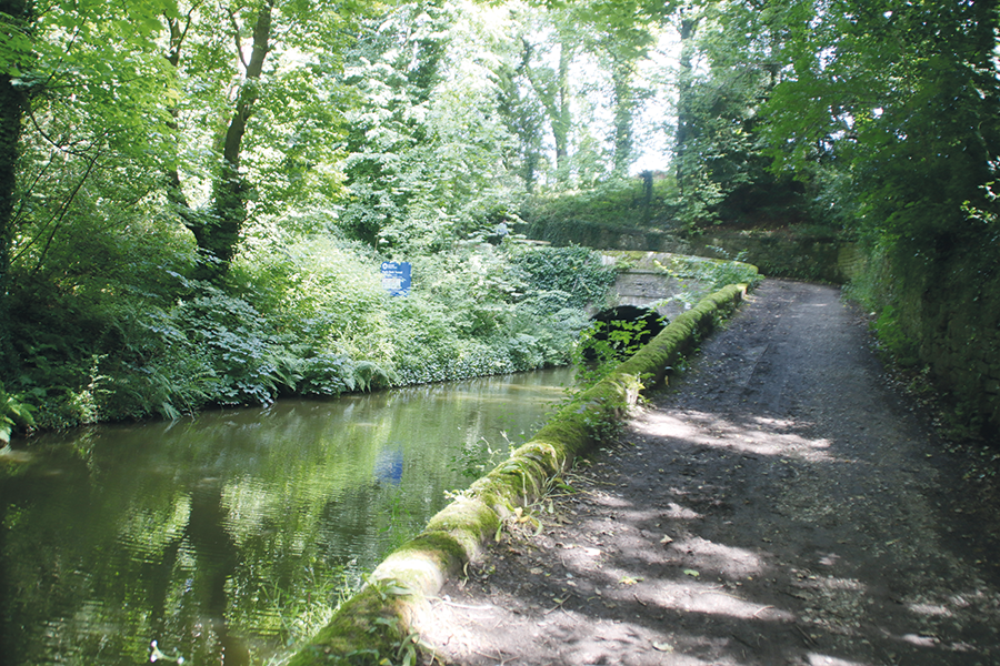
There are three locks in this first short flight at Ancoats, and between the second and third you’ll see an arm leading off on your left under a lift bridge carrying the towpath. This is the Islington Arm, one of a great number of branches that the Ashton once had (altogether their total lengths added up to more than double the length of the canal’s main line). Most of them are long abandoned (we’ll mention a couple of them shortly) but this one has been revived for private moorings – although sadly a proposal a few years ago to link it through to a branch of the Rochdale Canal, via a new lock and road bridge, foundered as a result of the costs of moving all the buried pipes and other services under the road.
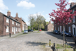 Fairfield Moravian settlement
Walk just a couple of hundred yards south of the Ashton Canal in the suburbs of Manchester and you’ll find yourself in another world, amid the cobbled streets, stone pavements and Georgian buildings of this self-contained urban village, planned and built by members of the Moravian Church starting in 1785, and still a living community today.
More old and new buildings line the route, but then the surroundings begin to open out a little as the canal approaches Sport City – the site for the Commonwealth Games which now combines the National Cycling Centre’s velodrome, the new Manchester City football stadium, athletics, squash, tennis and basketball. Meanwhile, another four locks continue the climb – and you’ll notice that their heights vary a great deal, from a mere three or four feet to more than three times that. This wasn’t the plan; subsidence over the years from former coal mining when this was still an industrial area has altered the ground levels.
After a short break the locks begin again with the start of the Clayton flight of nine, the lower locks still surrounded by a fair amount of light industry. A couple of former navigation features to look out for are the towpath bridge marking the former junction with the abandoned Stockport Branch, and the site of a swing bridge which used to carry a road (one that got quite busy in the rush hour) across the chamber of Lock 13.
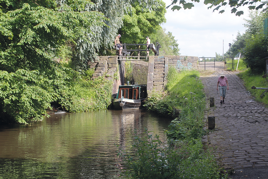
Subsidence has left some shallow locks and some very deep ones, like this one at Clayton
There’s just a mere half-mile gap (with two manually operated swing bridges – you’ll need your CRT key – to keep you busy in the meantime) before the final two locks climbing to the summit. You’ll see that this section of the canal was once so busy that these two locks were each duplicated side-by-side, and above the top one you’ll see another junction. Here the Hollinwood Branch headed off northwards to the outskirts of Oldham. This branch and the Stockport Branch were both abandoned as late as the 1960s (although they had already become unusable by then), but the struggle to keep the main line from following them into oblivion rather put paid to any idea of saving them. Both now are the subject of restoration plans (the first few yards of the Hollinwood have been reinstated as access to a mooring basin), and both are worth exploring on foot or by bike.
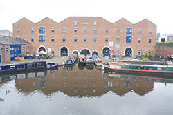 Portland Basin Museum
This former canal warehouse facing Dukinfield Junction was rebuilt after a fire in the 1970s as a museum with displays including a recreated 1920s street and local industrial heritage. While you’re there, look out for the historic former working boats of the Wooden Canal Boat Society moored in the basin outside.
Boat crews now get a rest as there are no more locks or swing bridges in the two miles from here to Ashton. The final mile was formerly surrounded by heavy industry and railway land and a fair amount of it remains, but growth of vegetation has softened it somewhat. Incidentally, this length was a focus for volunteer work during the canal’s restoration, with two ‘big dig’ major working parties (‘Operation Ashton’ in 1968 and ‘Ashtac’ in 1972) attracting hundreds of volunteers from the Peak Forest Canal Society, Inland Waterways Association, the embryonic Waterway Recovery Group (founded in 1970) and many other canal groups who shifted huge amounts of rubbish and helped set the canal on the path to reopening.
The summit of the Ashton was heavily industrialised, but much of that has been hidden by tree growth
It’s tempting to say that three canals meet at Dukinfield Junction, but that’s not quite true. Straight ahead leads to the Huddersfield Narrow Canal – but in fact the first half mile beyond the junction is still part of the Ashton. And a sharp right turn under a splendid junction towpath bridge leads to the start of the Peak Forest Canal – but once again, the actual change of name is a few yards beyond, on the far side of a sturdy stone aqueduct across the River Tame.
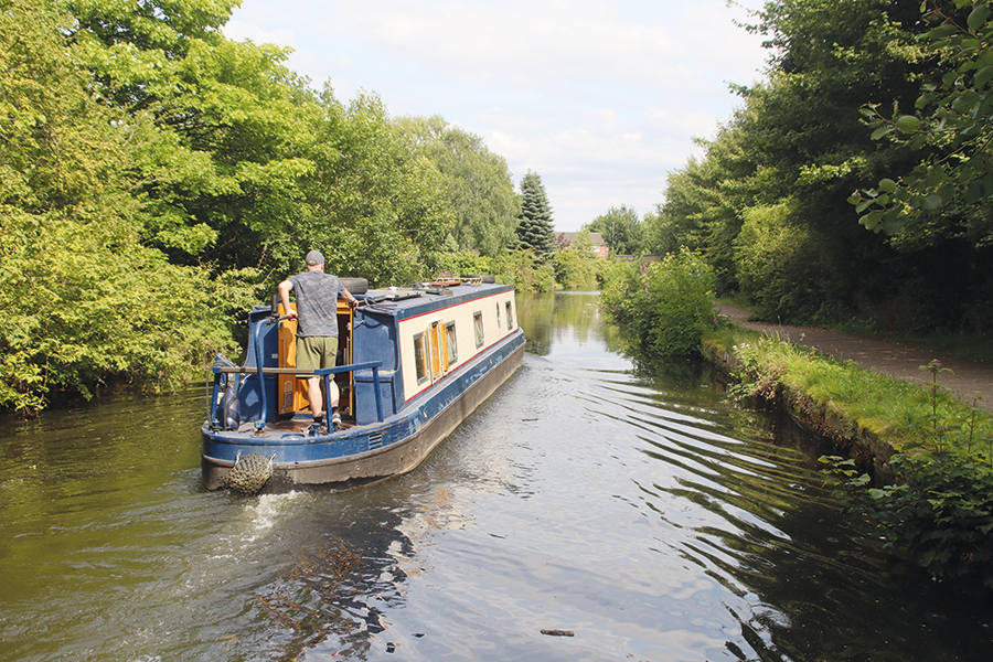
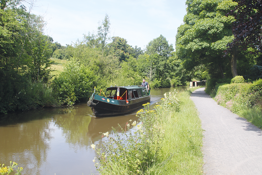
As might be expected, given that its only access from the rest of the canal system was via the Ashton, the Peak Forest was also built with narrow-beam locks for 70ft by 7ft locks. But it differed in terms of the distribution of the locks. While the Ashton’s locks are spread over four of its six miles, the 16 locks in the Peak Forest’s 14 miles are all close together in a single flight. This neatly divides the canal into two sections: from Dukinfield we are setting out south along the eight miles of what’s often known as the Lower Peak Forest, and that means a break from lock work for a while. There’s plenty of navigation interest, though, with a couple of lift bridges early on, as the canal follows the contours along the east side of the valley of the River Tame.

A rural length of the Lower Peak Forest south of Hyde
There’s also something of a change in the surroundings. Although it does have its industrial and urban lengths, they are increasingly interspersed with patches of open meadow and woodland especially on the west side. Passing a tunnel-like bridge under the M67 followed by the centre of Hyde (with handy shops) the canal soon returns to rural and wooded surroundings as it finally leaves behind the built-up area around Manchester.
As built, this length featured three tunnels: the 167-yard Woodley Tunnel, complete with towpath (watch out for the low and uneven roof), is followed a couple of miles further on by the longer Hyde Bank, 308 yards but without a towpath. Walkers can follow the old horse-path over the top, which rather unusually passes under a Grade II listed stone bridge carrying a private drive – bear right where the path splits. Between the tunnels, the canal passes through Romiley, with more shops nearby. And not far beyond Hyde Bank is a narrow, straight, masonry-lined cutting which is all that remains of the third tunnel, the 100-yard Rose Hill, which was opened-out at some point in the mid-to-late 19th Century following a collapse.
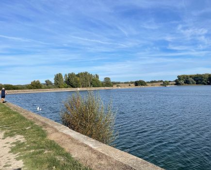
Beyond the cutting, a basin allows space to boats to pass each other before the channel once again narrows down as it approaches the greatest and most spectacular engineering structure on the canal. Marple Aqueduct spans the River Goyt on three stone arches at a height of 100ft above the river: the highest aqueduct in England and the second-highest in Britain after the Pontcysyllte. It’s worth stopping and following the path leading steeply down from the towpath to the river to really appreciate this remarkable structure – and one that could have been lost in the 1960s when it suffered severe frost damage at a time when the Ashton and Lower Peak Forest canals’ future was in doubt.
Unlike Woodley, Hyde Bank Tunnel lacks a towpath, but a tunnel path leads over the top
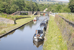
Just a few hundred yards beyond the aqueduct, the canal reaches its second major engineering feat. A flight of 16 locks, each around 13ft deep and built from monumental stone blocks, rises steeply up on a wooded embankment as the canal climbs the side of the Goyt Valley. They make an impressive and attractive sight, and the upper locks run through the edge of Marple town, so you’re likely to have plenty of passers-by to watch you pass through.
Incidentally, despite their solid appearance, the locks have been showing their age in recent years: three of the 16 lock chambers have unexpectedly required extensive rebuilding of the chamber walls following signs of the 220-year-old masonry moving inwards. Let us hope there are no more such nasty surprises on the way for the Canal & River Trust’s engineers.
Heading south from Marple on the Upper Peak Forest
Immediately above the top lock is Marple Junction. To the right, the Macclesfield Canal – a latecomer which didn’t arrive on the scene until 25 years after the Peak Forest – branches off on its route via Macclesfield to meet the Trent & Mersey Canal just north of Harecastle Tunnel, forming a short cut to the Midlands in working boat days, and the continuation of the Cheshire Ring circuit for today’s boaters. We’ll be featuring the Macclesfield in next month’s cruise guide, but for now we’ll continue past it on the remaining six-mile length of the Peak Forest, with visitor moorings just past the junction providing access to Marple’s shops and pubs.
We’re now on what’s known as the Upper Peak Forest, and with good reason: having crossed the Goyt on a 100ft high aqueduct and then climbed a further 200ft and more as we ascended Marple Locks, the canal is now high up on the valley side as it leaves Marple behind. Clinging to the contours as it winds its way through splendid scenery on the edge of the Peak District, the canal winds its way past Strines and Disley to reach New Mills. There are no more locks but both swing bridges and lift bridges are a feature of this upper length.
 Bugsworth Basin
This historic interchange was where limestone brought down on a tramroad from the quarries near Peak Forest was burned in kilns to make lime, which was then loaded into boats for the onward journey to Manchester. Now the whole complex of basins, wharves, arms, limekilns and relics of the old tramroad has been restored and is open to moor up and walk all around the site.
New Mills is (as the name suggests) a mill town, and a handy stop for shops – it’s also notable for the canalside Swizzels sweet factory, and for a spectacular new riverside walk suspended above the River Goyt in the bottom of its deep valley. The final length of canal continues southwards along the valley side through Furness Vale to reach a junction. For many years there was no real option: ahead for the canal’s Whaley Bridge terminus, or left for a short dead-end leading to where the line that formerly led to Buxworth Basin was dammed off. But in 2005, several decades of restoration work on the huge former interchange basin complex at Bugsworth culminated in a reopening to navigation – and it’s well worth the detour to visit (see inset).
Returning to the junction, the canal continues for just under half a mile to Whaley Bridge, where a terminus basin ends at a transhipment warehouse which was once the interchange with the remarkable Cromford & High Peak Railway, an early line reaching all the way across the Peak District to meet the Cromford Canal. Today, the warehouse and basin are home to a community group with Saturday markets and other events, you can walk the first section of the old railway, you’re close to the centre of this attractive stone-built town, and it’s a fine place to moor up before returning to Marple to continue your journey.
 As featured in the January 2025 issue of Canal Boat. Buy the issue here