In the second part of our guide to the ‘Shroppie’, we follow the northern length from Nantwich as the bold cuttings and embankments of the southern sections are left behind, and the canal takes a gentler route northwards to historic Chester and the Waterways Museum at Ellesmere Port
In the first part of this two-part guide to the Shropshire Union Canal, we headed north from Autherley Junction near Wolverhampton via the deep cuttings, high embankments and lock flights of the southern part of the canal to end at Nantwich in Cheshire. Here, the ‘Shroppie’ undergoes a sudden change – and that’s because historically we would have been leaving one waterway and joining another.
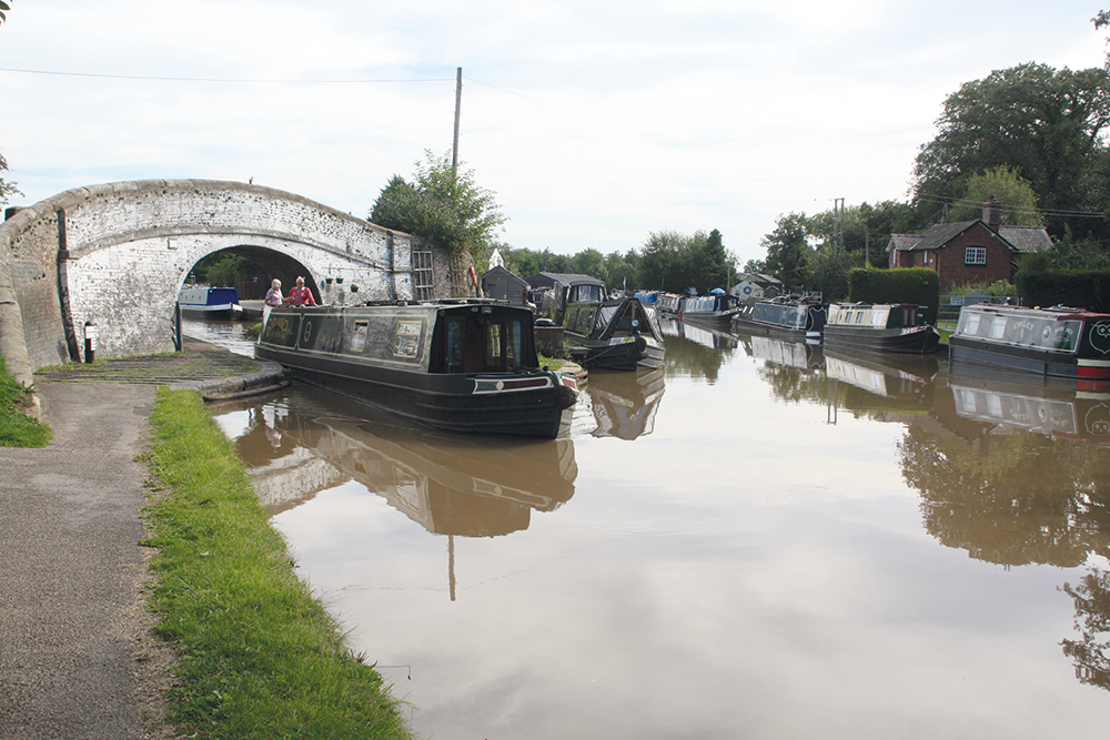
Leaving the former Birmingham & Liverpool Junction Canal and joining the older Chester Canal section of the Shroppie at Nantwich
We’re leaving what was originally the Birmingham & Liverpool Junction Canal, conceived as part of a more direct and faster long-distance route from the Midlands to the Northwest, and engineered by Thomas Telford at the very end of the main canal-building era as a state-of-the-art 1820s waterway; and we’re joining the former Chester Canal. Over 50 years older, it was built to the less advanced engineering of the 1770s, and today, that’s left us with a gentler waterway that fits in with its mostly rural surroundings, rather than striding across the landscape and cutting through the hills.
It may be an attractive and popular waterway today, but in the early days it was an almost complete failure. Planned to provide a link from the River Dee at Chester to Nantwich, and then via a branch to the Trent & Mersey Canal at Middlewich, it fell foul of two issues. Firstly, the Dee estuary and port of Chester, despite some improvements, were already losing out to the Mersey and Liverpool for foreign trade by sea, and this imbalance would be increased by the opening of the Trent & Mersey Canal (under construction at the time) which would connect via the Bridgewater Canal to the Mersey at Runcorn. And secondly, the owners of the Trent & Mersey Canal, who had no intention of losing out on this trade, refused to let the Chester Canal form a direct connection with their route at Middlewich.
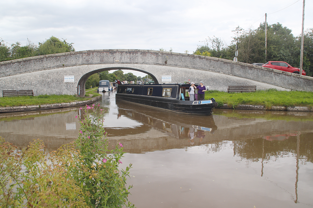
Leaving the Middlewich Branch at Barbridge Junction
Despite this, the Chester company pressed ahead and opened the main line of their canal from Chester to Nantwich in 1779. But with no more money to build the branch to Middlewich (with or without a connection to the T&M), they had little hope of commercial success. They tried running passenger boats, they tried digging for salt near their canal (but found none), and they tried a complicated through goods service involving road wagons connecting with boats on the Trent & Mersey. But within ten years of opening, the canal was almost bankrupt, part of it had had to be closed as a result of a lock collapse at Beeston, and there seemed little hope. It might not have survived, but for its future being secured by three other canals opening in the following years.
The first of these was the Ellesmere Canal, whose long and complicated history (planned as a north-south waterway from the Mersey to the Severn, it ended up as an east-west one) gave us what we know today as the Llangollen Canal, and whose connection to the outside world was via the Chester Canal at Hurleston Junction, bringing in some badly-needed through traffic.
Second, was the Birmingham & Liverpool Junction Canal, Telford’s modern through route of the 1830s which we’ve already mentioned. And thirdly, the long-planned branch from the Chester Canal to Middlewich was finally built, the Trent & Mersey company having dropped their opposition on realising that there might now be something in it for them. Between them these three connections turned the Chester Canal from a forlorn and almost unused dead-end into an important link in the network – and an amalgamation of these and other canals in the 1840s gave us the ‘Shropshire Union’ name that we use today.
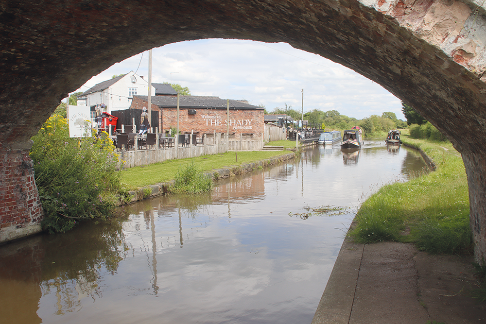
A tempting canalside pub near Beeston
So, we begin our cruise, having emerged under the last narrow-beam towpath bridge at Nantwich, to enter the older, gentler and wider Chester Canal. That’s right – wider. Being originally only connected to the River Dee, it was built for typical river barges of the day, so its locks and other structures take craft up to about 72ft by 14ft – not that you’ll see many such craft today, as it’s not easy for them to get there from elsewhere on the network.
A small basin to the left marks the original terminus of the Chester Canal, and is home to a useful boatyard, while to the right, the through route continues northwards.
Incidentally, it’s well worth stopping off for a look at Nantwich before continuing – it’s an attractive market town and former salt-mining centre, with a large number of historic half-timbered buildings surviving from when the town was rebuilt after a major fire had destroyed it in 1583.
Leaving Nantwich behind, in just under two miles at a wide rectangular basin on the left, we meet the second of those useful later connections whose construction saved the Chester Canal. At Hurleston Junction the Llangollen Canal branches off, climbing immediately through the four Hurleston Locks accompanied by Hurleston Reservoir. And just over another mile further on we meet the third of these connections, as the Middlewich Branch turns off to the right under a fine towpath bridge at Barbridge Junction.
Generally regarded more as a useful link than a cruising route in its own right, the Middlewich Branch does nevertheless have much interest of its own. Four deep narrow locks descend to the Trent & Mersey, as the canal makes its way across the Cheshire countryside in a series of sweeping bends and straight reaches typical of a later canal. Venetian and Aqueduct marinas provide boater services, Church Minshull village has a pub, and there are views down to Winsford Top Flash from where the canal runs adjacent to the River Weaver on a high embankment (there was even a suggestion of a new navigable link here 20 years ago in the optimistic days around the new Millennium when brand new waterway projects were starting to actually happen elsewhere).
And we must mention a curiosity at the Middlewich end where it meets the Trent & Mersey: the fourth lock isn’t actually part of the Middlewich Branch at all, as the Trent & Mersey company, despite abandoning their opposition to the new link, still wanted control over the junction and insisted on building the last few yards and final lock (Wardle Lock) themselves. This is commemorated by the junction bridge carrying the name ‘Wardle Canal’, often quoted as the “World’s shortest canal”. Wardle itself is actually a small settlement back near Barbridge Junction.
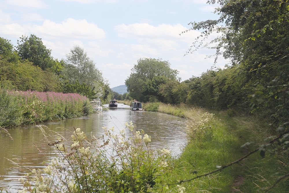
Near Waverton, with Beeston Castle’s mound just visible in the distance
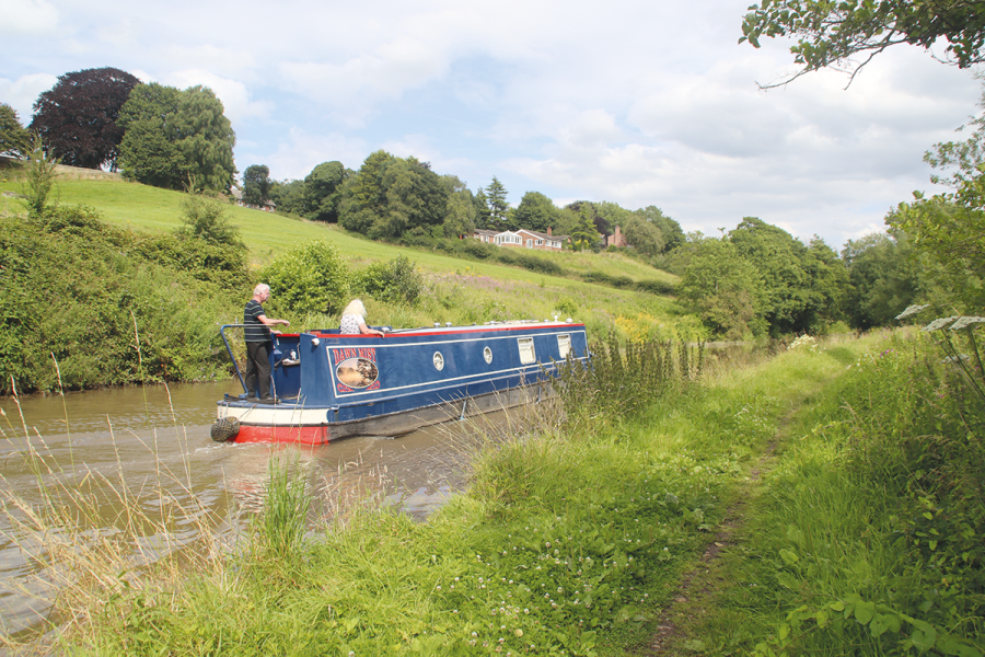
Meanwhile, back on the Shropshire Union main line, a rare interruption to the canal’s peaceful progress is the result of a main road running alongside the waterway for a couple of miles, but at Calveley their courses diverge and the canal follows the attractive valley of the little River Gowy. We haven’t seen any locks in the six miles since leaving Nantwich, but this long level comes to an end at Bunbury, where a pair of locks begin the descent down the Gowy valley and towards Chester. The locks are in the form of a staircase, with the upper chamber leading straight into the lower one, so follow the usual practice for these: always begin with the upper lock full and the lower lock empty, and you shouldn’t go wrong. Of course, being wide-beam locks, the narrowboats which make up almost all of the traffic here can share side-by-side, or alternatively if they are single, they can pass boats coming the other way in the staircase. Local boaters are keen on what’s known as the ‘Bunbury Shuffle’ – two boats in one direction passing a single boat going the other way, accompanied by the necessary shuffling from side to side in the locks. Take it carefully if you do this!
A boatyard accompanies the staircase, which marks the start of a series of locks making a gentle descent towards Chester. At Beeston there are two locks – a conventional one known as Beeston Stone Lock and one with a chamber made of metal plates bolted together and known as Beeston Iron Lock. This was the lock that was mentioned earlier as having collapsed causing a closure during the struggles of the canal’s early years; it turned out to have been built on unstable ground, and was rebuilt in cast iron plates to prevent a recurrence. It succeeded and still stands, but it has warped over the years reducing its width, so narrowboats are not recommended to share it side-by-side.
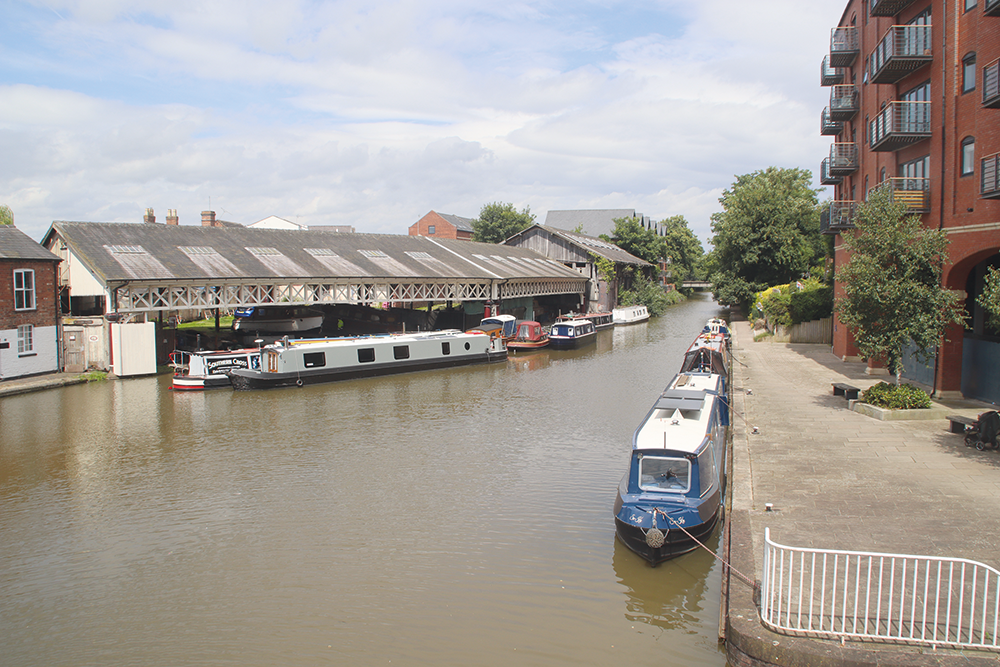
The Chester boatyard where Taylor’s used to make traditional varnished wooden leisure boats
Look out for Beeston Castle, high on a rocky hill to your left (see inset) as the canal passes Wharton’s Lock, the last for some time as the canal enters flatter countryside. Look out also for a handy waterside pub, and for a small aqueduct approached by a sharp bend which crosses the River Gowy. The Crewe to Chester railway keeps the canal company as it passes a popular mooring area with long lines of boats in otherwise quiet countryside. Villages tend to be set back from the canal but Waverton provides shops, and is followed closely by Christleton village (with another waterside pub), and the last of the countryside before the approach to Chester.
After another length level pound (eight miles this time), the locks begin again on the run in to Chester with five spread out over a couple of miles. Look out for the curious circular brick lock keeper’s hut at several of them, complete with curved door. The towpath is popular with Chester’s walkers as the surroundings become more urban. This was once quite an industrial length with evidence still to be seen in the form of old warehouse buildings (at least three in the city have been converted to waterside pubs – see our pubs list) plus a prominent water tower, a former shot tower, and the name of Chemistry Lock. At Hoole Lane Lock the River Dee is just a couple of hundred yards away to the left, but the route by water is rather longer – see later.
The last stretch into the city runs through a lively area with repurposed old buildings on both sides, but then the canal undergoes a transformation as it approaches the ancient City Walls. Curving to run alongside the Wall, the canal enters a deep, narrow and rocky cutting as the ground rises on both sides, passing under a high bridge carrying the road approaching the city’s North Gate.
This is followed by a former footbridge known as the ‘Bridge of Sighs’ – named after the more famous one in Venice, and for a similar reason – it was the last sight of the outside world that condemned prisoners would have as they were led from the cells across the canal to the chapel to receive the last rites.
The deep and gloomy cutting comes to an end as the land drops away at Northgate Locks, a three-rise staircase dropping down towards the River Dee. It’s a dramatic and steep flight, largely hewn out of the solid red sandstone rock, and there are often Canal & River Trust volunteer lock keepers on duty to help boaters. The locks are followed immediately by a railway bridge carrying the North Wales coast line, and then a very sharp right turn, rather out of character for this mostly gently curving waterway. The reason is that it wasn’t always like this: as originally built (remember, its function was to connect to the River Dee), there were five locks in the staircase and they descended directly to a small basin at the far end of which a pair of tidal gates opened directly into the river. But then came another of those later developments which helped to improve the prospects for the ill-starred early Chester Canal.
As part of the Ellesmere Canal’s early plans to link the Mersey to the Severn, an initial length was planned to run across the Wirral peninsula from the Mersey to the Dee, beyond which the canal would continue up the Dee Valley to Ruabon and Llangollen. The part beyond Chester was abandoned as plans changed, but the length from the Mersey to the Dee was built. And at Chester it would have met the existing Chester Canal part way down the five-lock staircase at Northgate. So, the locks were reduced to three, the canal was diverted to run via the new Tower Wharf to continue across the Wirral, and new arm with a series of three single locks was built from Tower Wharf to provide the connection to the Dee.
Tower Wharf is an excellent site to moor up and explore all that the city has to offer: the historic City Walls (see inset), the Rows (unique double tiers of shops running along the city’s main street), museums, Roman remains, cathedral and riverside. There’s also a boatyard, boater facilities, and nearby shops, while a plaque attached to a fine brick and iron-built towpath turnover bridge records that famous canal revival pioneer LTC (Tom) Rolt was born in this city.
Leaving Chester on what was originally the Wirral Line of the Ellesmere Canal, there isn’t much of a difference to the nature of the waterway as it runs behind gardens and gradually leaves the city. Taking a quiet route across the flat land of the Wirral (there are no more locks), it winds past Chester Zoo (walkable from Bridge 134) to reach Stoak, the only village on this length of the waterway with a handy pub. From there on, the canal is increasingly disturbed by noise from a series of motorways and main roads, but manages to retain a fairly rural or tree-lined appearance as it approaches the terminus at Ellesmere Port. This takes its name from the town of Ellesmere in Shropshire, which the Ellesmere Canal (later the Llangollen Canal) aimed to serve. Before the canal arrived, all that existed here was a tiny hamlet on the south bank of the Mersey Estuary named Netherpool, but engineer Thomas Telford planned to make it his ‘port for Ellesmere’. The canal plans may have changed, but he did create one of our greatest canal ports, with warehouses and locks connecting basins at different levels – and it benefited when the less reliable tidal navigation on the Mersey Estuary was replaced by the Manchester Ship Canal running along its south bank through Ellesmere Port and connecting with the older canal.
Sadly, following the end of trade on the canal, the old main warehouse providing two-level interchange been canal and lower basins was destroyed in a fire, but the remainder of the buildings were saved from disappearing, and since the 1970s have housed the Ellesmere Port National Waterways Museum.
The navigation does still continue beyond here, with the parallel broad and narrow lock flights linking to the Ship Canal for an adventurous cruise either west to Eastham Locks for the passage across the Mersey to Liverpool Docks and the Leeds & Liverpool Canal, or east up the Ship Canal to either the River Weaver at Marsh Lock or Manchester via Salford Docks and Pomona Lock. Neither of these are to be undertaken lightly, and there’s a fair bit of Ship Canal paperwork to be dealt with – take advice if you’re considering making either trip.
However, for most visiting boaters the Museum will be the main attraction of continuing this far – and it’s well worth it, and a fine finale to the 66-mile journey from Autherley Junction..

